|
Anacostia River Watershed Database and Mapping Project Software & Data
 |
|
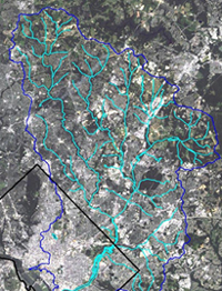
Landsat Image of the Anacostia River Watershed
|
Partnering for Restoration
NOAA's Assessment and Restoration Division (ARD) is working to clean up and restore the Anacostia River Watershed. Located in Maryland and Washington, DC., the Anacostia River is one of the Chesapeake Bay's most heavily altered and toxic watersheds. PCBs, petroleum chemicals, heavy metals, fecal material and pesticides pollute the river. Only 6% of the area's original forests remain, and over 95% of the tidal wetlands have been lost. Historic fisheries are gone, remaining fish are unsafe to eat, and the river is unsafe for swimming. Since 1999, NOAA has been working in partnership with local, state and federal agencies as well as local citizen groups to reverse these problems.
Clean up efforts require that NOAA works in partnership with several other organizations to address all aspects of the project. Work with the Anacostia Watershed Society addresses the thousands of tons of trash that end up in the river annually. The Metropolitan Council of Governments and NOAA are collaborating in efforts to implement source-reduction strategies. Restoration of wetland sites and enhancing public access along the river are examples of efforts with the National Park Service, EPA, the District of Columbia, and the Maryland State Highway Administration. With EPA, we continue to identify and cleanup toxics in the Anacostia. NOAA is also participating in the Anacostia Watershed Restoration Committee, a multi-agency and citizen group effort. One of the group's charges is helping develop and implement a habitat restoration proposal for the watershed.
 |
|
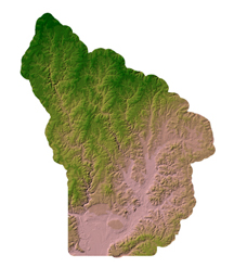
Shaded Relief Image of the Anacostia River Watershed Drainage
|
GIS and Mapping
ARD originally developed the Anacostia River Watershed Project as part of its membership in the Anacostia Watershed Toxics Alliance. The Alliance was formed as a public-private consortium to work together in good faith as partners to evaluate the impacts of contaminants of the river and to take actions to restore the river to its beneficial use. The Alliance is unique among other organizations working on the Anacostia because of its focus on toxic contaminants.
The Anacostia River Watershed Database and Mapping Project is comprised of a database and a GIS mapping component. The project focus is on contaminants in the sediments and on restoration projects. This decision-making tool is intended to help partner agencies and local citizen groups identify priorities and base watershed management decisions using the same sets of data. The contamination component is available to download from this site. The GIS component of the project available to the public online from an Internet Mapping Server.
For general information on data related to this project:
|
|
|
- Query Manager and MARPLOT An introduction to the Query Manager and MARPLOT applications that are used extensively throughout the ARD watershed projects
|
|
|
Other Pages on Anacostia River Projects:
|
- Poplar Point Restoration A description of ARD's investigative and restoration efforts for the District of Columbia on the former DC Lanham Tree Nursery at Poplar Point, Washington D.C.
|
|
|
|
|
|