|
ARD IMS Sites
ARD has developed Internet Map Server (IMS) sites of watershed GIS data to assist Coastal Resource Coordinators, natural resource managers, and the public in accessing and analyzing relevant geographic data. These IMS sites contain selected data from our Watershed Database and Mapping Projects and can be utilized to assist in resource protection and restoration planning.
By using IMS technology, we are able to bring these geospatial data to anyone with access to an Internet browser. There is no need to run specific GIS software or download data; the project and data layers are already constructed and available for immediate viewing and analysis.
Requirements
These projects have been tested on several platforms and browsers. The following is a list of what we find works best.
Platforms | Browsers | Connection | Win XP
Win 2000
Win Millenium | Internet Explorer 5+
Mozilla
Netscape Navigator 6+ | DSL, cable modem, T1, T3 | Mac OS X
Mac OS 9 | Mozilla
Netscape 6+
Safari
|
Current and Draft CPRD IMS Sites
These links will take you to both completed IMS sites and works in progress. The draft sites allow our partners to review project data without having to load an entire GIS project or worry about subsequent draft versions. |
- San Francisco Bay Subtidal Habitat Mapping Project In an effort to better manage and restore San Francisco Bay subtidal habitats, NOAA's National Ocean Service (NOS) and NOAA's National Marine Fisheries Service (NMFS) collected and analyzed data on the quantity and quality of existing subtidal habitats within the San Francisco Bay as part of the NOS partnership project, "Management and restoration of sub-tidal habitat: Decision-making tools and habitat mapping." [leaves OR&R site]
|
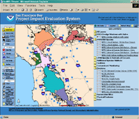
- San Francisco Bay Project Impact Evaluation System The PIES mapping project was designed to provide data used by NOS and NMFS in the San Francisco Bay region to other agencies working on coastal resource projects in the Bay. It provides access to information pertinent to planning port maintenance, development, and environmental permitting. Although the available GIS map layers alone do not provide a solution to many complex environmental issues facing San Francisco, these layers can help to streamline permit review by providing a basic level of visual information for ports with complex dredging and construction issues. [leaves OR&R site]
|
|
|
|
|
- Anacostia River Watershed This project focuses on restoration projects and contaminantion within the watershed and highlights other spatial information collected by local, state, and federal agencies plus local interest groups. [leaves OR&R site]
|
|
|
Other pages in this series
|
- Using the ARD IMS Sites If you have never used an Internet mapping application, there are a few things you may want to familiarize yourself with before starting.
|
|
|
|