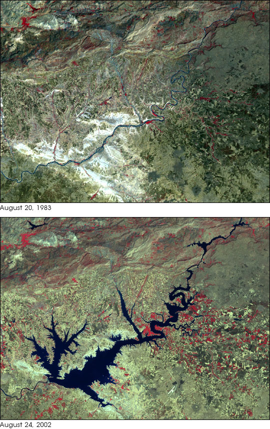
Turkey’s Ataturk Dam was completed in 1990. It is the largest of a series of dams along the two major
rivers of the region, the Tigris and Euphrates, which both have their headwaters in southeastern
Turkey. Built both to generate electricity for the region and to irrigate the plains between the
Euphrates (on which it sits) and the Tigris (to the east), Ataturk Dam is the centerpiece of a huge public works
program within Turkey known as the Southeastern Anatolia Project. When the entire program of
reservoirs, power generation stations, and irrigation channels is constructed,
it will irrigate some 1.7 million hectares (4.2 million acres). The reservoir already provides 8.9 billion
kilowatt hours of electricity, roughly 22 percent of Turkey’s anticipated electrical
needs in 2010, when the project is expected to be completed. With
the dam now finished, as well as the first of the irrigation channels,
crops such as cotton are being grown in the Harran Plains
in the dry season, where previous irrigation was limited to borewater and much less land was
in active production.
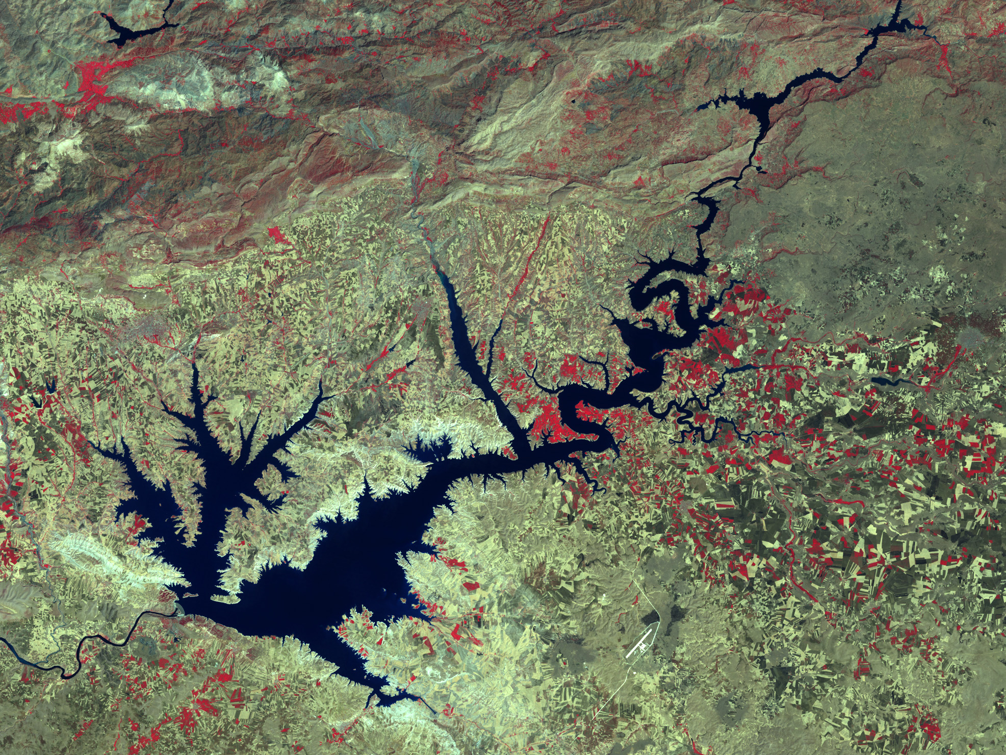
In this pair of Landsat images, the dramatic growth of the Ataturk Dam Lake in the space of
19 years is quite apparent. The newly formed lake, sometimes referred to as a sea by locals,
covers some 817 square kilometer (320 square miles) in total surface area.
These images were acquired by the Landsat 4 Multispectral Sensor (MSS) and the Landsat 7 Enhanced Thematic Mapper Plus (ETM+) instruments. The first image was acquired by MSS on August 20, 1983, and the second by ETM+ on August 24, 2002. Both false-color composite images
were constructed by combining near-infrared, red, and green wavelengths (MSS bands 3, 2, and 1;
ETM+ bands 4, 3, and 2).
Landsat 4 MSS image obtained from the
University of Maryland’s
Global Land Cover Facility.
Landsat 7 ETM+ image provided courtesy of USDA Foreign Agricultural Service
Production Estimates
and Crop Assessment Division (PECAD).
Recommend this Image to a Friend
Back to: Newsroom
Also see

|
|
Latest Images
View Images Index
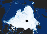
Arctic Sea Ice Reaches Annual Minimum
Tunis, Tunisia
Klondike Gold Rush National Historical Park, Alaska
|
