|

Webcam in remote, high-risk burn area.
DATA CENTER
INFORMATION CENTER
ABOUT THE CALIFORNIA WSC
USGS IN YOUR STATE
USGS Water Science Centers are located in each state.

|
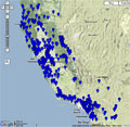
Webcams of the California Water Science Center
 Webcams have been installed at several real-time sites
and more are planned. The webcams provide valuable information
to the National Weather Service, emergency managers, and area residents to
evaluate real-time conditions in river environments during storms.
The visual record of flooding and other river events also provides
valuable research data for the USGS. Many of these webcam installations
are part of the USGS Multi-Hazards Demonstration Project.
Webcams have been installed at several real-time sites
and more are planned. The webcams provide valuable information
to the National Weather Service, emergency managers, and area residents to
evaluate real-time conditions in river environments during storms.
The visual record of flooding and other river events also provides
valuable research data for the USGS. Many of these webcam installations
are part of the USGS Multi-Hazards Demonstration Project.
|
|
|
|
| Proposed |


Sacramento River
Northern CA
|
|