- HOME
- DAILY GPI
- SHALE DAILY
- NGI
- DATA
- Forward Look Price "Snapshot"
- Daily Price "Snapshot"
- Weekly Price "Snapshot"
- Bidweek Price "Snapshot"
- Bidweek Alert Data
- Shale Gas Prices (subscriber-only)
- Price Data "Learn More"
- > NGI Daily Price Methodology (pdf)
- > NGI Shale Price Methodology (pdf)
- > Publishing Calendar 2014/2015 (pdf)
- > NGI Datafeed Spec and Automation

 )
)

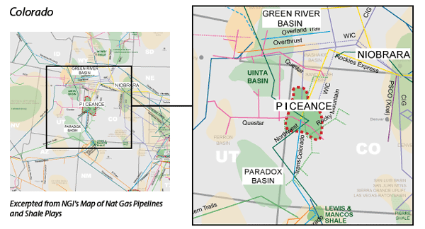
Piceance Basin

Piceance Overview:
Located in Northwest Colorado, the Piceance (pronounced pee-aunts) Basin is a tight sands formation that lies at depths between 6000’-10000’, and features liquids rich natural gas.
Read More
Piceance Counties:
CO: Delta, Garfield, Gunnison, Mesa, Moffat
Read More
Piceance Pipelines (natural gas):
CIG, Northwest Pipeline, Questar, Rockies Express, TransColorado, White River Hub, WIC
Read More
Piceance Net Acreage Table:
A table detailing the net acreage owned by various companies in the Piceance play.
View Table