Erie, Colorado
| Town of Erie, Colorado | |
|---|---|
| Town | |
| Motto: Your Future Is Here | |
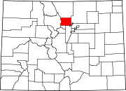
 Location in Boulder County and the state of Colorado |
|
| Coordinates: 40°03′01″N 105°03′00″W / 40.05028°N 105.05000°WCoordinates: 40°03′01″N 105°03′00″W / 40.05028°N 105.05000°W | |
| Country | |
| State | |
| Counties[1] | Boulder County Weld County |
| Incorporated | November 15, 1885[2] |
| Government | |
| • Type | Statutory Town[1] |
| • Mayor | Tina Harris[3] |
| Area | |
| • Total | 17.3 sq mi (44.8 km2) |
| • Land | 17.2 sq mi (44.5 km2) |
| • Water | 0.1 sq mi (0.3 km2) |
| Elevation | 5,130 ft (1,564 m) |
| Population (2010) | |
| • Total | 18,135 |
| • Density | 1,056/sq mi (407.6/km2) |
| Time zone | MST (UTC-7) |
| • Summer (DST) | MDT (UTC-6) |
| ZIP codes[4] | 80154 & 80516 |
| Area code(s) | Both 303 and 720 |
| FIPS code | 08-24950 |
| GNIS feature ID | 0178731 |
| Website | www.erieco.gov |
|
|
|
Erie is a Statutory Town in Boulder and Weld counties in the U.S. state of Colorado. The population as of the 2010 census was 18,135,[5] up from 6,291 at the 2000 census. Erie is located just west of Interstate 25, with easy access to Interstate 70, Denver International Airport and Colorado's entire Front Range. Erie's Planning Area spans 48 square miles (120 km2), extending from the north side of State Highway 52 south to State Highway 7, and between US 287 on the west and Interstate 25 to the east.[6] Erie is approximately 35 minutes from Denver International Airport, 25 minutes from Denver and 20 minutes from Boulder.
Contents
Government[edit]

The Board of Trustees serves as the legislative and governing body of the town of Erie and is responsible for establishing town policies and goals. The board has the authority to adopt laws, ordinances and resolutions as needed to conduct the business of the town, and by ordinance may enter into contracts or intergovernmental agreements to furnish, receive services or to provide for cooperative service delivery.
Appointed by and serving at the pleasure of the Board of Trustees, the Town Administrator is the chief operating and administrative officer of the town and is responsible for providing professional leadership in the administration and execution of policies and objectives formulated by the board.
The mission of the Erie Police Department is to communicate and work with the community to maintain a safe environment, prevent crime and enforce the law, while protecting the rights of all.
Erie Municipal Airport (EIK) is owned and operated by the Town of Erie and is located on Colorado Highway 7, a little over three miles west of Interstate 25. The main runway is concrete paved and 4,700 feet (1,400 m) long.
History[edit]
From "Erie History", Town of Erie website:
Prior to the 1870s and the development of the northern coal fields, settlers living along Coal Creek eked out their living as farmers or merchants. The few communities existing along the Front Range were miles apart by stagecoach or horseback.
Throughout the 1860s, stagecoach companies delivered freight, mail and passengers to destinations along the foothills. The Overland Stage traveled from Denver to Laramie each day, following much the same route as the present U.S. Highway 287. Contact with distant friends and relatives improved with the coming of the railroad to Erie in 1871. Even after its arrival, however, travelers heading to Longmont had to continue on by stagecoach or spring wagon. Those bound for Boulder detrained at the Erie terminal and boarded a stage for the final destination.
Social interaction among early settlers was limited, and families traveled great distances to attend church, school or grange meetings. Many relied on circuit-riding preachers to bring them the gospel once or twice a month. Such a man was Reverend Richard Van Valkenburg, civic leader and a founder of Erie. Having spent many years as a Methodist preacher in the coal towns near Erie, Pennsylvania, the Reverend thought it fitting to bestow that name on its western counterpart.
The original plat for Erie was filed in 1871, following establishment of the Briggs Mine, the first commercial coal mine in Weld County. Until that time, surface coal had been delivered to its customers by horse and wagon.
It was also in 1871 that the Union Pacific Railroad extended a spur westward from Brighton on its main line between Denver and Cheyenne. Coal from the Erie deposits was needed to fuel their huge steam locomotives. The Boulder Valley Railroad, as it was called then, opened up the northern coal fields for development. Soon coal from Erie mines was being shipped by rail to markets in Denver and as far east as Kansas City.
The Town of Erie was incorporated in 1874.[7]
Geography[edit]
Erie is located in the southwest corner of Weld County at 40°2′25″N 105°3′28″W / 40.04028°N 105.05778°W[8] and extends west into eastern Boulder County. It is bordered to the south by the city of Broomfield and to the southwest by the city of Lafayette. Interstate 25 forms part of the eastern border of the town, leading south 22 miles (35 km) to downtown Denver and north 41 miles (66 km) to Fort Collins. Erie is served by Exit 232 off I-25.
According to the United States Census Bureau, Erie has a total area of 17.3 square miles (44.8 km2), of which 17.2 square miles (44.5 km2) is land and 0.12 square miles (0.3 km2), or 0.74%, is water.[5]
Demographics[edit]
| Historical population | |||
|---|---|---|---|
| Census | Pop. | %± | |
| 1880 | 358 |
|
|
| 1890 | 662 | 84.9% | |
| 1900 | 697 | 5.3% | |
| 1910 | 596 | −14.5% | |
| 1920 | 697 | 16.9% | |
| 1930 | 930 | 33.4% | |
| 1940 | 1,019 | 9.6% | |
| 1950 | 937 | −8.0% | |
| 1960 | 875 | −6.6% | |
| 1970 | 1,090 | 24.6% | |
| 1980 | 1,254 | 15.0% | |
| 1990 | 1,258 | 0.3% | |
| 2000 | 6,291 | 400.1% | |
| 2010 | 18,135 | 188.3% | |
|
|
|||
As of the 2010 Census, there were 18,135 people in the Town of Erie. According to the 2009 American Community Profile, the racial makeup of the town was 90.6% White, 0.3% African American, 0.1% Native American, 4.1% Asian, 0.00% Pacific Islander, 2.4% from other races, and 2.6% from two or more races. Hispanic or Latino of any race were 9.7% of the population.
According to the Town of Erie Community Development Department, there were 6,485 households. According to the US Census the average household size was 2.91.
Population: Under 5 years - 9.6%, 5 to 9 years - 10.3%, 10 to 14 years - 7.4%, 15 to 19 years - 5.4%, 20 to 24 years - 2.7%, 25 to 29 years - 4.9%, 30 to 34 years - 8.1%, 35 to 39 years - 10.4%, 40 to 44 years - 9.8%, 45 to 49 years - 8.5%, 50 to 54 years - 7.25%, 55 to 59 years - 5.5%, 60 to 64 years - 4.5%, 65 to 69 years - 2.5%, 70 to 74 years - 1.4%, 75 to 79 years - 0.9%, 80 to 84 years - 0.5%, 85 and older - 0.35.
The median income for a household in the town was $99,804, and the median income for a family was $108,058. The per capita income for the town was $38,965.
Education: Public schools[edit]
St. Vrain Valley School District: Erie Elementary, Erie Middle School, Erie High School, Black Rock Elementary, Red Hawk Elementary, and Aspen Ridge Preparatory School (charter school established in 2011).
Erie Community Center[edit]
The Erie Community Center is a 63,000-square-foot (5,900 m2) state-of-the-art facility operated by the Town of Erie Parks & Recreation Department. The facility was constructed with many sustainable features including a thermal solar water heating system.
Arts in Erie[edit]
There is an active group of artists in Erie; the Arts Coalition of Erie (a 501(c)(3) represents about 70 artists, or approximately 60% of the artists in town. There are good venues for art at the Erie Community Center and High Plains Library, and shows change about every two months.
The Art Center of Erie (known as the A.C.E.) at 625 Pierce Street in Old Town Erie is open for visual and performing arts programs and is operated by the Arts Coalition of Erie. Classes and events are held year round at the site (an old children's library owned by the Town of Erie) leased by the Arts Coalition of Erie.
Notable residents[edit]
- Constantina Dita, 2008 Beijing Olympic Marathon gold medalist
- Erdne Ombadykow, Tibetan Buddhist leader
Notable businesses[edit]
See also[edit]
- Outline of Colorado
- State of Colorado
References[edit]
- ^ a b "Active Colorado Municipalities". State of Colorado, Department of Local Affairs. Retrieved 2007-09-01.
- ^ "Colorado Municipal Incorporations". State of Colorado, Department of Personnel & Administration, Colorado State Archives. 2004-12-01. Retrieved 2007-09-02.
- ^ "Board of Trustees". Town of Erie, Colorado. Retrieved 15 April 2014.
- ^ "ZIP Code Lookup" (JavaScript/HTML). United States Postal Service. Retrieved September 11, 2007.
- ^ a b "Geographic Identifiers: 2010 Demographic Profile Data (G001): Erie town, Colorado". U.S. Census Bureau, American Factfinder. Retrieved September 26, 2013.
- ^ "Town of Erie, Colorado: 2005 Comprehensive Plan; Land Use Plan Map". Town of Erie. Retrieved September 26, 2013.
- ^ "Erie History". Town of Erie. Retrieved September 26, 2013.
- ^ "US Gazetteer files: 2010, 2000, and 1990". United States Census Bureau. 2011-02-12. Retrieved 2011-04-23.
External links[edit]
| Wikimedia Commons has media related to Erie, Colorado. |
- Town of Erie official website
- Erie News at DailyCamera.com
- Colorado Hometown Weekly, Erie's weekly newspaper
- Erie Economic Development Council
- Erie Historical Society
- Erie Community Forum at My Colorado Town
- Arts Coalition of Erie
|
|||||||||||||||||||||||||||||
|
|||||||||||||||||||||||||||||||||
