


| « Back to Article |
Texas City dike closed after barge and ship collide
By Anita Hassan, Jayme Fraser, Harvey Rice, Ingrid Lobet | March 22, 2014 | Updated: March 23, 2014 7:23pm

-
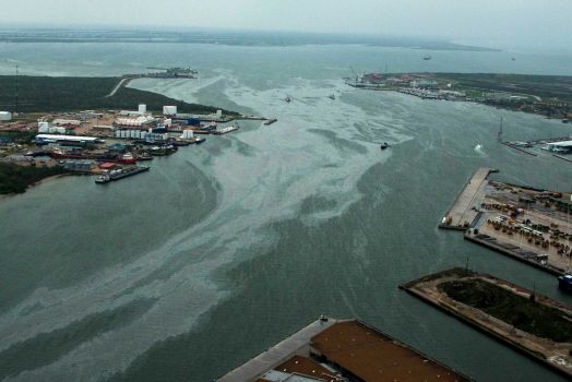 Photo By Smiley N. Pool/Houston Chronicle
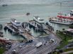
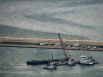
Cleanup vessels are surrounded by a sheen on the water in the Port of Galveston on Sunday, March 23, 2014, in Galveston, Texas. Dozens of ships are in evolved in clean-up efforts to remove oil that spilled into Galveston Bay after a ship and barge collided near the Texas City dike on Saturday afternoon.
-
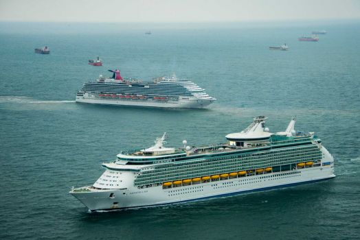 Photo By Smiley N. Pool/Houston ChronicleThe Royal Caribbean Navigator of the Seas and the Carnival Magic sit idle with dozens of other ships off the coast of Galveston, Texas on Sunday, March 23, 2014. At least 33 vessels, including two cruise ships, are waiting to enter the Houston Ship Channel from the Gulf of Mexico after a ship and barge collided near the Texas City dike on Saturday afternoon.
 -
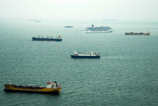 Photo By Smiley N. Pool/Houston ChronicleDozens of ships sit idle off the coast of Galveston, Texas on Sunday, March 23, 2014. At least 33 vessels, including two cruise ships, are waiting to enter the Houston Ship Channel from the Gulf of Mexico after a ship and barge collided near the Texas City dike on Saturday afternoon.
 -
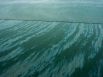
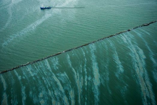 Photo By Smiley N. Pool/Houston ChronicleA sheen is seen on the water as a vessel works near the Galveston Jetties on Sunday, March 23, 2014, in Galveston, Texas. Dozens of ships are in evolved in clean-up efforts to remove oil that spilled into Galveston Bay after a ship and barge collided near the Texas City dike on Saturday afternoon.
 -
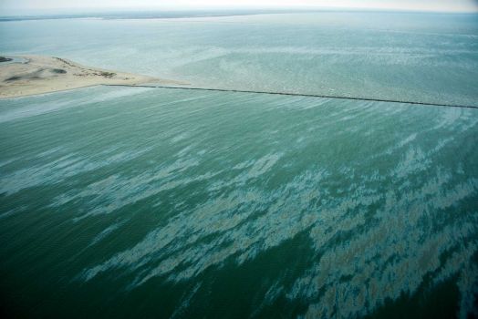 Photo By Smiley N. Pool/Houston ChronicleA sheen is seen on the water near East Beach and the Galveston Jetties on Sunday, March 23, 2014, in Galveston, Texas. Dozens of ships are in evolved in clean-up efforts to remove oil that spilled into Galveston Bay after a ship and barge collided near the Texas City dike on Saturday afternoon.
 -
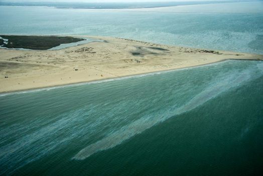 Photo By Smiley N. Pool/Houston ChronicleA sheen is seen on the water near East Beach on Sunday, March 23, 2014, in Galveston, Texas. Dozens of ships are in evolved in clean-up efforts to remove oil that spilled into Galveston Bay after a ship and barge collided near the Texas City dike on Saturday afternoon.
 -
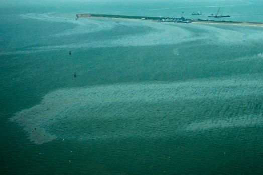 Photo By Smiley N. Pool/Houston ChronicleA sheen in seen on the waters of Galveston Bay near where crews work along a barge that spilled oil after it was struck by a ship near the Texas City Dike on Sunday, March 23, 2014, in Galveston. Dozens of ships are in evolved in clean-up efforts to remove oil that make have spilled into after a ship and barge collidedon Saturday afternoon.
 -
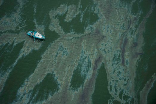 Photo By Smiley N. Pool/Houston ChronicleA vessel surrounded by a sheen on the water near the Port of Galveston on Sunday, March 23, 2014, in Galveston, Texas. Dozens of ships are in evolved in clean-up efforts to remove oil that spilled into Galveston Bay after a ship and barge collided near the Texas City dike on Saturday afternoon.
 -
 Photo By Smiley N. Pool/Houston ChronicleCleanup vessels are surrounded by a sheen on the water near the Port of Galveston on Sunday, March 23, 2014, in Galveston, Texas. Dozens of ships are in evolved in clean-up efforts to remove oil that spilled into Galveston Bay after a ship and barge collided near the Texas City dike on Saturday afternoon.
 -
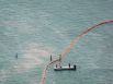
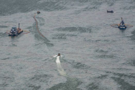 Photo By Smiley N. Pool/Houston ChronicleVessels work with skimmers and oil containment booms in Galveston Harbor on Sunday, March 23, 2014, in Galveston. Dozens of ships are in evolved in clean-up efforts to remove up to 168,000 gallons of oil that make have spilled into Galveston Bay after a ship and barge collided near the Texas City dike on Saturday afternoon.
 -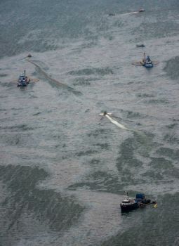
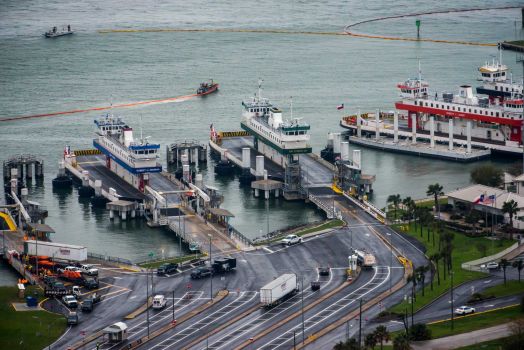 Photo By Smiley N. Pool/Houston ChronicleOil containment booms are spread out near the idle Galveston-Bolivar Ferry terminal on Sunday, March 23, 2014, in Galveston. Dozens of ships are in evolved in clean-up efforts to remove up to 168,000 gallons of oil that make have spilled into Galveston Bay after a ship and barge collided near the Texas City dike on Saturday afternoon.
 -
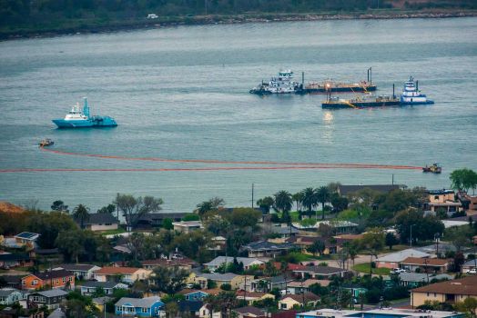 Photo By Smiley N. Pool/Houston Chronicle
Oil containment booms are spread out in Galveston Harbor on Sunday, March 23, 2014, in Galveston. Dozens of ships are in evolved in clean-up efforts to remove up to 168,000 gallons of oil that make have spilled into Galveston Bay after a ship and barge collided near the Texas City dike on Saturday afternoon.
-
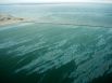
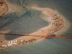
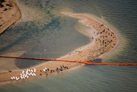 Photo By Smiley N. Pool/Houston ChronicleOil containment booms cuts across a sand bar covered with birds on Pelican Island on Sunday, March 23, 2014, in Galveston, Texas. Dozens of ships are in evolved in clean-up efforts to remove up to 168,000 gallons of oil that make have spilled into Galveston Bay after a ship and barge collided near the Texas City dike on Saturday afternoon.
 -
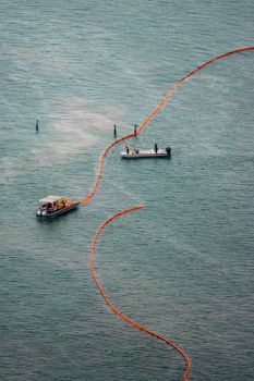 Photo By Smiley N. Pool/Houston ChronicleCrews place protective boom along the seashore near Port Boliver on Sunday, March 23, 2014, in Port Bolivar, Texas. Dozens of ships are in evolved in clean-up efforts to remove up to 168,000 gallons of oil that make have spilled into Galveston Bay after a ship and barge collided near the Texas City dike on Saturday afternoon.
 -
 Photo By Smiley N. Pool/Houston ChronicleCrews place protective boom along the seashore near Port Bolivar on Sunday, March 23, 2014, in Port Bolivar, Texas. Dozens of ships are in evolved in clean-up efforts to remove up to 168,000 gallons of oil that make have spilled into Galveston Bay after a ship and barge collided near the Texas City dike on Saturday afternoon.
 -
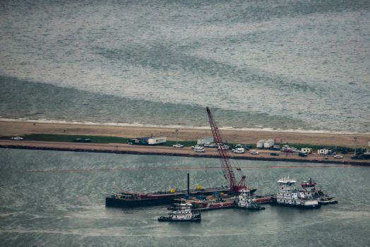 Photo By Smiley N. Pool/Houston ChronicleEmergency crews work along a barge that spilled oil after it was struck by a ship near the Texas City Dike on Sunday, March 23, 2014, in Texas City. Dozens of ships are in evolved in clean-up efforts to remove up to 168,000 gallons of oil that make have spilled into Galveston Bay after a ship and barge collided near the Texas City dike on Saturday afternoon.
 -
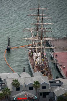 Photo By Smiley N. Pool/Houston ChronicleProtective boom surrounds tall ship Elissa at the Port of Galveston on Sunday, March 23, 2014, in Galveston, Texas. Dozens of ships are in evolved in clean-up efforts to remove oil that spilled into Galveston Bay after a ship and barge collided near the Texas City dike on Saturday afternoon.
 -
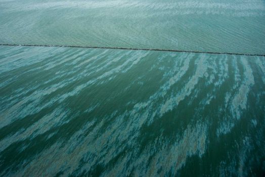 Photo By Smiley N. Pool/Houston ChronicleA sheen is seen on the water near East Beach and the Galveston Jetties on Sunday, March 23, 2014, in Galveston, Texas. Dozens of ships are in evolved in clean-up efforts to remove oil that spilled into Galveston Bay after a ship and barge collided near the Texas City dike on Saturday afternoon.
 -
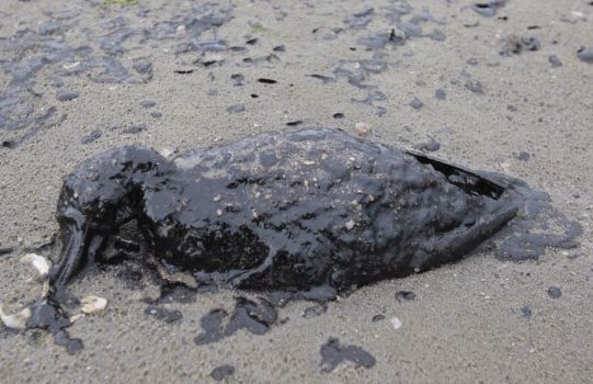 Photo By Melissa Phillip/Houston Chronicle
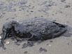
A dead oil covered bird is shown washed ashore on the beach area along Boddeker Rd. on the east end of Galveston near the ship channel Sunday, March 23, 2014 in Galveston.
-
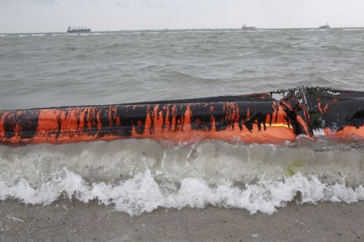 Photo By Melissa Phillip
An oil covered boom is show on the beach area along Boddeker Rd. on the east end of Galveston near the ship channel Sunday, March 23, 2014 in Galveston.
-
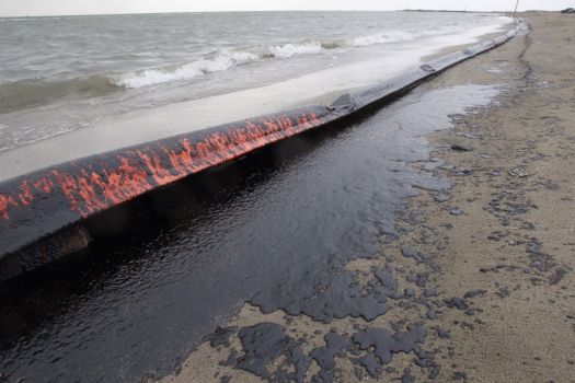 Photo By Melissa Phillip/Houston Chronicle
An oil covered boom is washed ashore on the beach area along Boddeker Rd. on the east end of Galveston near the ship channel Sunday, March 23, 2014 in Galveston.
-
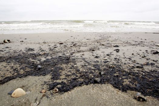
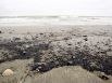
A black sticky oily substance is shown along the beach at the Texas City Dike near the barge spill cleanup site Sunday, March 23, 2014. Officials say the material is consistent with how oil could appear when it impacts beaches. However it would have to be analyzed to determine its origin. (Melissa Phillip / Houston Chronicle)
-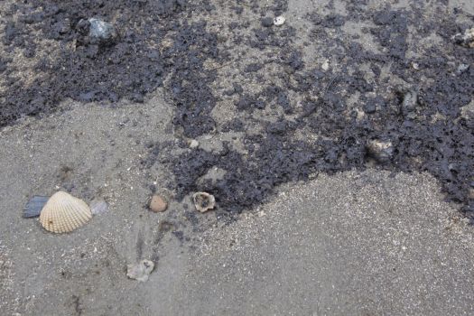
Emergency crews work along a barge that was struck by a ship shown near the Texas City Dike Sunday, March 23, 2014. (Melissa Phillip / Houston Chronicle)
-
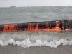
A reader caught this image of the ship spewing liquid soon after impact Saturday in the Texas City Dike area. (Janet Lee Knizner-Enders / For the Chronicle)
-
A reader caught this image of the ship spewing liquid soon after impact Saturday in the Texas City Dike area. (Janet Lee Knizner-Enders / For the Chronicle)
-
A reader caught this image of the ship spewing liquid soon after impact Saturday in the Texas City Dike area. (Janet Lee Knizner-Enders / For the Chronicle)
-
A reader caught this image of the ship spewing liquid soon after impact Saturday in the Texas City Dike area. (Janet Lee Knizner-Enders / For the Chronicle)
-
A reader caught this image of the ship spewing liquid soon after impact Saturday in the Texas City Dike area. (Janet Lee Knizner-Enders / For the Chronicle)
-
A reader caught this image of the ship spewing liquid soon after impact Saturday in the Texas City Dike area. (Janet Lee Knizner-Enders / For the Chronicle)
-
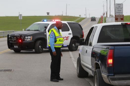
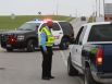
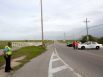
Texas City police Cpl. Mickey House mans a roadblock at the entrance of the Texas City Dike on Sunday, March 23, 2014. (Melissa Phillip / Houston Chronicle)
-
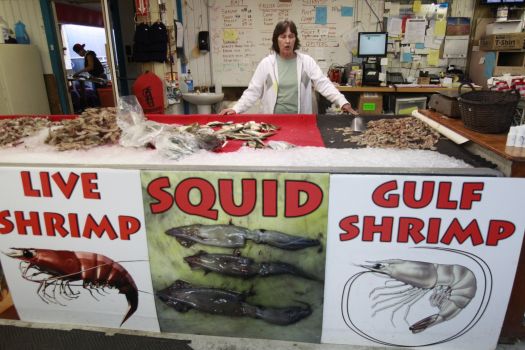 Photo By Melissa Phillip/Houston Chronicle
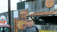
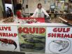
Denise Pickle, shift manager at Boyd's One Stop, talks at the bait shop that is located next to the entrance of the Texas City Dike Sunday, March 23, 2014. She said, "We survived Ike, we will survive this one." (Melissa Phillip / Houston Chronicle)
-
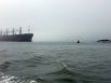
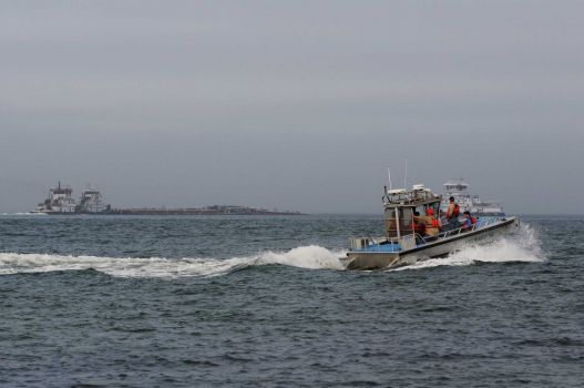 Photo By Neal Mora/PhotographerA response boat heads to the scene of a collision between a ship and barge near the Texas City Dike on Saturday.
 -
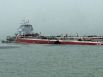
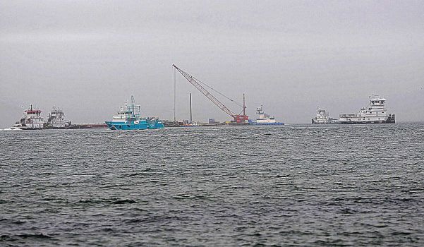 Photo By Neal Mora/Neal Mora/The Galveston County DNEAL MORA/Special to The Galveston County Daily News A crane works to stabilize a barge after a collision with a ship in the ship channel near the Texas City Dike on Saturday afternoon March 22, 2014. Two workers on one of the vessels were exposed to hydrogen sulfide and decontaminated by the first department at the end of the dike.
 -
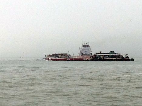
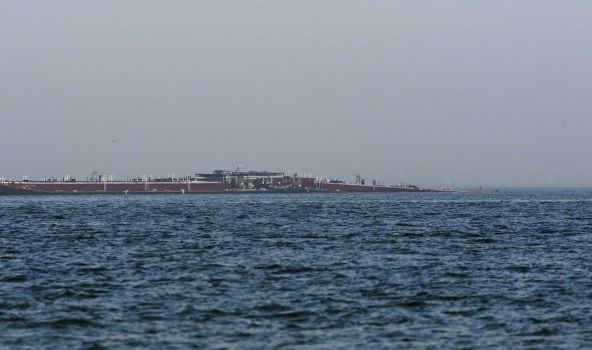 Photo By Neal Mora/Neal Mora/The Galveston County DNEAL MORA/Special to The Galveston County Daily News A barge begins to sink after a collision with a ship in the ship channel near the Texas City Dike on Saturday afternoon March 22, 2014. Two workers on one of the vessels were exposed to hydrogen sulfide and decontaminated by the first department at the end of the dike.
 -
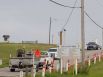
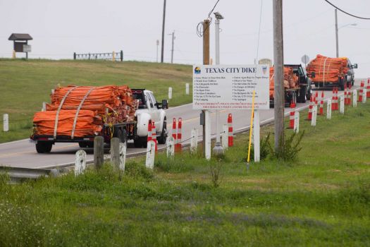 Photo By Brett Coomer/Houston ChronicleEnvironmental personnel drive onto the Texas City Dike with oil containment booms for oil remediation following a barge collision in the ship channel, causing an oil spill Saturday, March 22, 2014, in Houston.
 -

Emergency crews work along a barge that was struck by a ship shown near the Texas City Dike Sunday, March 23, 2014. (Melissa Phillip / Houston Chronicle)
-
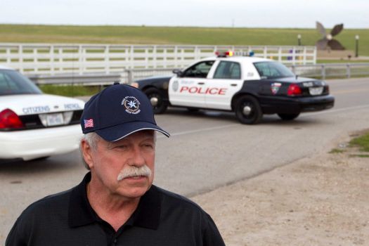 Photo By Brett Coomer/Houston ChronicleBruce Clawson, Texas Emergency Management director, gives a news conference near the Texas City Dike following a barge collision in the ship channel, causing an oil spill Saturday, March 22, 2014, in Houston.
 -
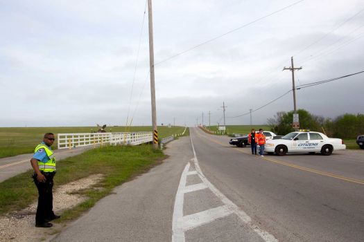 Photo By Brett Coomer/Houston ChronicleEmergency personnel block the road to the Texas City Dike following a barge collision in the ship channel, causing an oil spill Saturday, March 22, 2014, in Houston.
 -
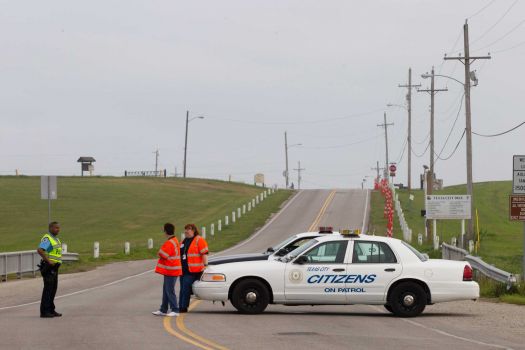 Photo By Brett Coomer/Houston ChronicleEmergency personnel block the road to the Texas City Dike following a barge collision in the ship channel, causing an oil spill Saturday, March 22, 2014, in Houston.
 -
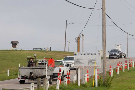 Photo By Brett Coomer/Houston ChronicleEnvironmental personnel drive onto the Texas City Dike for oil remediation following a barge collision in the ship channel, causing an oil spill Saturday, March 22, 2014, in Houston.
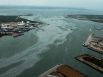

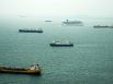


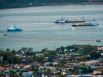


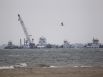
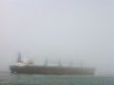


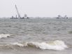


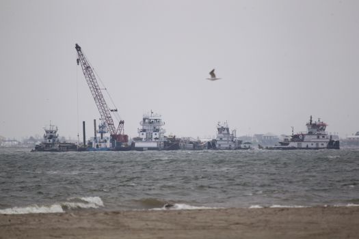
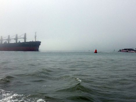
Dozens of ships are piling up Sunday as clean-up efforts continue to remove the up to 168,000 gallons of oil spilled into Galveston Bay after a ship and barge collided near the Texas City Dike Saturday afternoon.
Marine traffic in the Houston Ship Channel from the Intracoastal Waterway to buoy 32 is suspended for the safety of responders, authorities said. The ferry connecting Galveston Island and the Bolivar Peninsula is also suspended.
At least 33 vessels, including two cruise ships, are waiting to enter the channel from the Gulf of Mexico. Thirty-six vessels, including one cruise ship, are waiting to leave Galveston Bay, according to Lt. Sam Danus.
The waterways and ferry will not be opened until the water is clear, which could take several days, if not weeks, officials said.
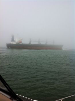
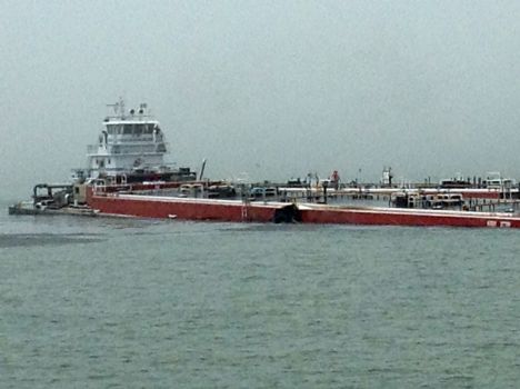
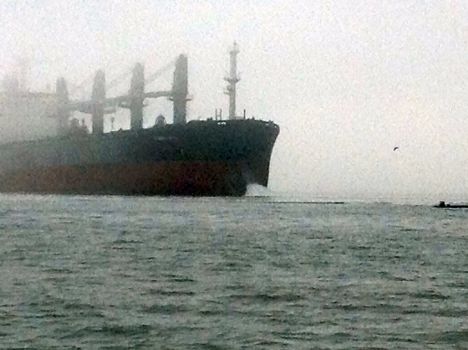
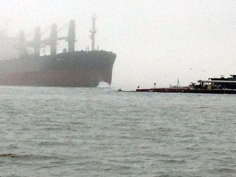
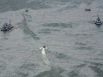
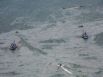
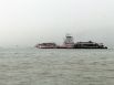
Skimming vessels were dispatched Sunday to scoop up oil that leaked after a cargo tank was breached when a barge carrying 924,000 gallons of oil collided with the 585-foot Summer Wind, a Liberian flag bulk vessel built in 1995.
That cargo tank hauled nearly 4,000 barrels, meaning as much as 168,000 gallons of the fuel could have spilled from that compartment into the bay, Coast Guard spokesman Lt. Junior Grade Kris Kidd said. Any oil remaining on the barges has been removed, authorities said Sunday, although they refused to say how much reached the water.
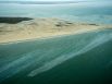
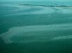
Authorities reported a sheen of oil in the water shortly after the wreck. They identified the substance as RMG 380, a special bunker fuel oil often used in shipping that doesn't evaporate easily.
"This is an extremely serious spill," said Capt. Brian Penoyer of the U.S. Coast Guard. "It is a persistent oil."
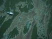
Crews laid more than 90,000 feet of containment boom around the spill, including barriers to protect the ecologically critical Big Reef at the end of Galveston Island and Little Pelican Island. They closed a tidal gate where Moses Lake connects with Galveston Bay, officials said.
The U.S. Coast Guard said officials are closely monitoring air quality for health-threatening hydrogen sulfide and other dangerous gases, Coast Guard Lt. Sam Danus said.
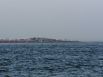
Authorities headed up in a helicopter Sunday morning to see the extent of the spill for the first time, said Greg Pollock, deputy commissioner of the oil spill prevention response program of the Texas General Land Office. Fog and other weather had limited the line-of-sight for platform lookouts Saturday, he said.
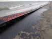
A line of sticky black tar from the oil spil has washed onto the Texas City Dike beach and their are reports of oil on Galveson's East Beach.
Volunteers are mobizing to help impacted wildlife. A rehabilitation trailer from Corpus Christi is expected to arrive in Texas City for trained volunteers to work with affected animals.
Bob Stokes, president of the Galveston Bay Foundation, said his group will coordinate all volunteers for the response, but noted only trained professionals will work with oil and animals. He directed anyone interested in volunteering to sign up at www.galvbay.org, primarily for clerical, construction, communication or general behind-the-scenes work.
Stokes said the potential impact of the spill on birds, both local and migratory, could be substantial because of the numerous nesting areas in the bay, particularly Bolivar Flats Shorebird Sanctuary near the collision site.
"There's a lot of bird nests right there on the beaches of Bolivar Flats," he said. "Birds would be pretty susceptible to getting oiled wings."
Tides could push the oil south toward the flats if a north wind does not stall it, he said. The area had been surrounded by containment boons, but Stokes noted they are not 100 percent effective. High winds, large waves and the probability that birds would fly past them and dive into the sheen could spread the spill beyond boons.
Geoff Roberts, 38, who was fishing Saturday with his wife and friend, said he saw the barge after the collision, which took place in what Coast Guard officials called a common crossing between the Intracoastal Waterway and the Houston Ship Channel.
Roberts said conditions were foggy when he headed out onto the water around noon. After he launched his boat from the Texas City Dike, he said the occupants of other boats coming past were shouting that there had been an accident.
Later, Roberts found oil on his own 21-foot-boat, Amberjack, as well as his fishing gear.
"You could see a big oil slick as far as the eye could see," he said.
Kirby Inland Marine, owner of the motor vessel named Miss Susan and the barges, activated its emergency response plan and is working to help the Coast Guard and the Texas General Land Office, which are on scene.
The park at the end of the 5-mile long Texas City dike was crammed with trucks and equipment supporting efforts to raise the barge, halt the oil leak and contain the spill. It served as a staging area for the deployment of thousands of feet of orange boom. Scores of workers wearing hard hats labored to deploy the long, snaking booms to protect sensitive areas.
Several hundred yards east from the tip of the dike, an area known as the Texas City Y, hundreds of flood lights lit work barges clustered around the sunken oil barge near the intersection of the Ship Channel and the Intracoastal Waterway.
The Texas City Y is so named because it's the point where ships can turn west to enter the Port of Texas City or continue along the Ship Channel.
Clean-up efforts are expected to take days, which could force ships to reroute and cost the economy millions of dollars.
Port of Houston Authority Chairman Janiece Longoria said "the closing of the ship channel is always of concern to the Port Of Houston Authority and to all Houston Ship Channel users, including the many private facilities operated by industry along the channel."
"The Coast Guard is handling coordination of spill containment, and we are confident in their ongoing emergency response," Longoria wrote in a text message. "It is unclear at this point how long the channel may be closed or the financial impact to industry stakeholders, and to POHA and its customers. We are monitoring this situation very closely."
Harris County Commissioner Jack Morman, whose Precinct 2 encompasses a large portion of the Houston Ship Channel, said a closure lasting a day or two - common during foggy weather - is not a big deal, but that he was told by port officials that this one could last longer.
"It is concerning when you start getting closures of multiple days in a row," Morman said. "You start really having an impact on our local economy, and regionally and nationally as well ... It just really highlights the importance of the ship channel and what they do out there."
"They've got experience with closures, it's just something like this ... really has the potential to be a more substantial event," he said.
Investigators are working to determine fault in the wreck.
The Summer Wind's Liberian flag is among the most common flown by merchant ships, which often register with a nation based on cost and regulations rather than what would common sense would call the country of origin.
Registering with a foreign nation can "provide owners with more operating flexibility and lower operating costs," including the ability to transfer vessels between registries at will, no income taxes, no staffing requirements, no limits on where vessels can be built or repaired, and no government safety inspections, according to a 2011 report of the U.S. Department of Transportation's Maritime Administration.
The total average cost of operating a vessel with a U.S. flag - with all the fees and regulations tied to it - is 2.7 times higher than foreign-flag equivalents, according to a 2011 report of the U.S. Department of Transportation's Maritime Administration. In part, that has resulted in many more U.S.-owned vessels choosing different flags, a practice called "flying a flag of convenience." At the end of 2010, 110 commercial ships participating in international commerce flew a U.S. flag, but more than 540 other American-owned vessels registered in 31 foreign countries.
Staff writers Kiah Collier and Erin Mulvaney contributed to this report.
Contribute to this story:


Related Video


 Facebook
 Twitter
 LinkedIn
 Newsletters
 RSS
RSS