
As we've written before, there are a number of reasons to be concerned about drilling in the Arctic. We've seen the devastation caused by a blowout in the relatively calm waters of the Gulf of Mexico, and this drilling operation is 385 miles northeast of Gazprom's controversial Prirazlomnaya platform that Greenpeace activists boarded last year.
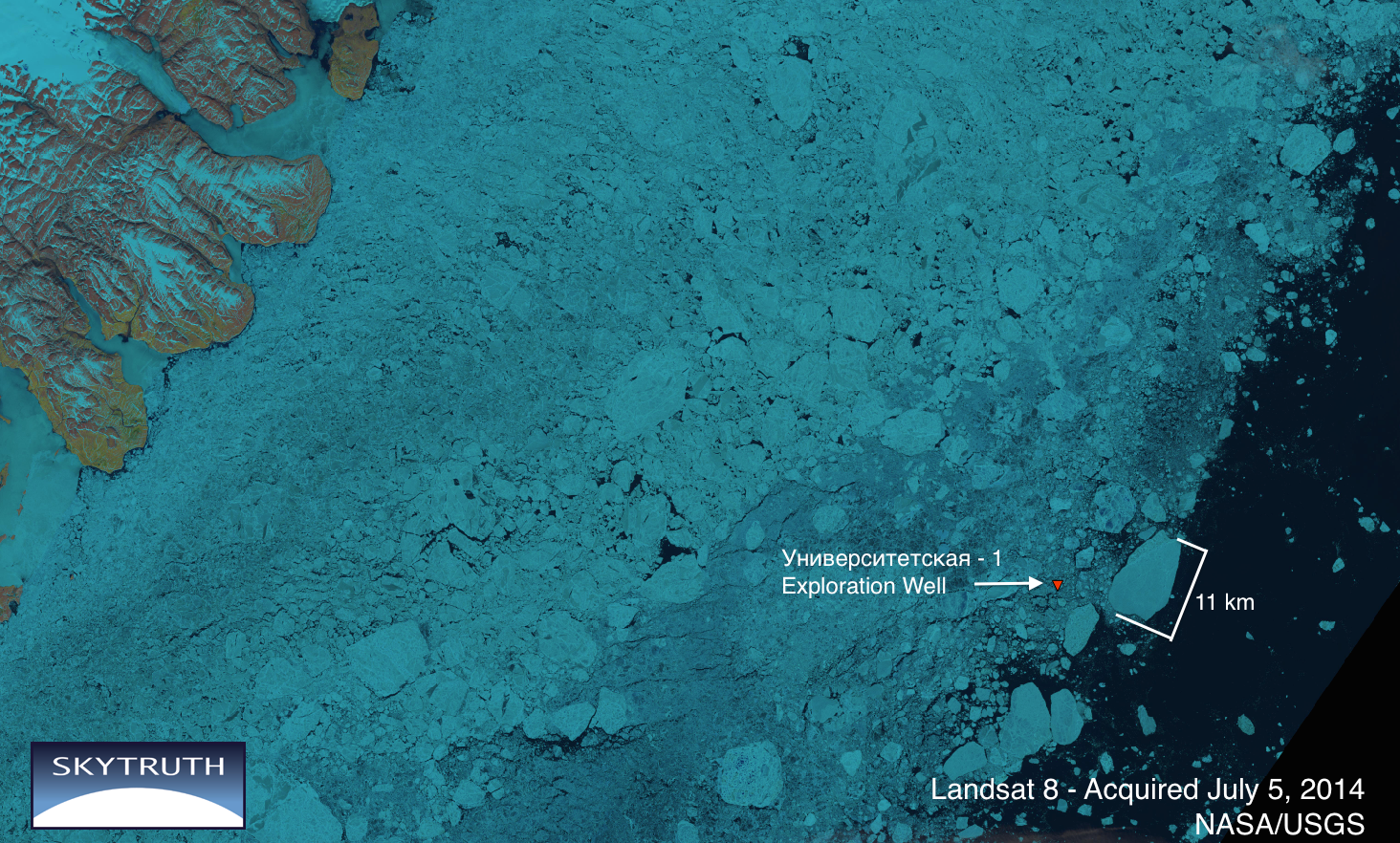
What is so worrying about drilling in the Arctic? Aside from the unforgiving weather that can tear a 28,000 ton drill rig from its support vessels and drive it ashore, there are no technologies proven to clean up spilled oil from the ice that covers the region most of the year. And this ice is always moving: consider what the Kara Sea looked like in July (above) compared to August (below). At 68² km, the 11 km long chunk of ice identified above is larger than Manhattan. According to Rosneft, the West Alpha rig is outfitted with sensors to track advancing sea ice, and they claim to be able to shut-in the well and move the rig if necessary.

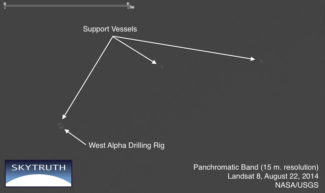
(Above) As of August 22 the ice had retreated.
Clouds often block the view of electro-optical satellites like Landsat, but synthetic aperture radar on satellites like the European Space Agency's Sentinel 1-A can peer through clouds and collect data on vessel locations, oil slicks, and sea ice, day or night. While we wait for Sentinel to begin routine data collection, we are watching vessel activity around the West Alpha rig using satellite AIS tracking data. (To read more about our work with satellite AIS, click here)
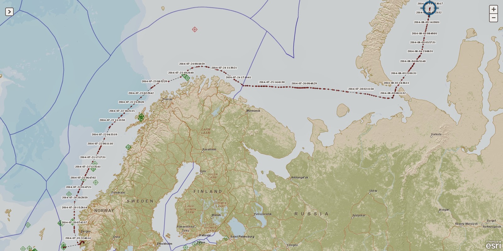
(Above): AIS data show the path taken by the West Alpha rig as it was towed from Norway to its current location in the Kara Sea.

It is worth noting that the West Alpha rig has not broadcast its location since August 14. It is not to clear to us from the IMO regulations if they are required to continually broadcast their location until they are safely back in port, but it is not uncommon for drill rigs to stop broadcasting when they are "on-station" and not moving.
According to Rosneft, drilling began in early August and was expected to take two months. But under these new sanctions Exxon has to wind down their activity and secure the well by the end of September.
The U.S. Treasury Dept. has granted a "brief extension" for ExxonMobil to wrap up their drilling operations and safely secure their operations in the Universitetskaya Prospect:
ReplyDeletehttp://www.reuters.com/article/2014/09/19/us-usa-exxon-russia-idUSKBN0HE27C20140919